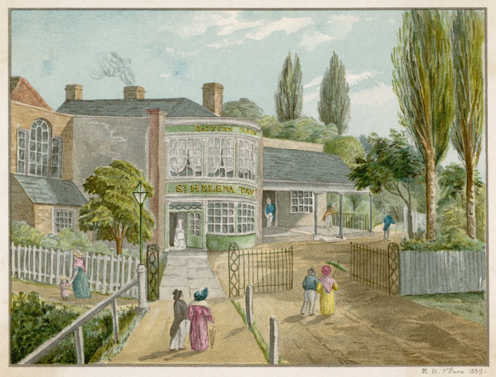
Before the site of what would become the Silwood Estate was developed in the late 19th century, The St. Helena Tavern and Tea Gardens were a centre of entertainment and recreation for working class Londoners and the surrounding rural communities. Tea gardens were places in which people could get away from the sights and smells of urban London and St. Helena’s provided lawns, ponds, trees, statues and two Chinese pavilions. At the time it was surrounded by hay fields and a range of hills that formed from east to west.
Picture courtesy of the Mary Evans Picture Library.
As seen on the map below from 1868, the gardens were adjacent to what was known as a ‘Rope Walk.’ These long lanes were used for stretching out hundreds of metres of rope fibre in order for them to be twisted (or ‘layed‘) into strong, functional rope for use on the Docks.
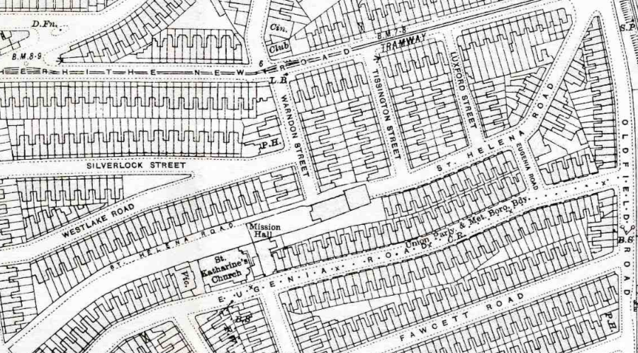
On this map from 1914, (around 30 years after the demolition of the St. Helena Tavern and Gardens,) the site has been developed into what is now part of the Silwood Estate. However on the west end of St. Helena Road, part of the rope walk still exists and can still be viewed to this day.
Silwood related books, maps, DVDs and prints can all be found and purchased from Spectacle’s Shop.
Click Silwood Video Group for more blogs
Or visit PlanA our general blog on urbanism, planning and architecture.
See our Silwood Video Group project pages for more information and videos.
Spectacle homepage
Befriend Spectacle.Docs on Facebook
Follow SpectacleMedia on Twitter


